
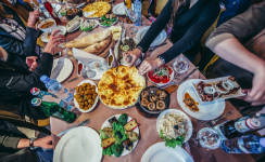
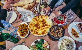
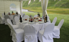
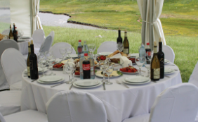
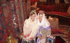
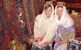
Fabulous Cuisine
Explore the rich flavors of traditional Caucasian dishes. Indulge your taste buds with regional specialties prepared with care by renowned chefs or kitchen household wonders.


.png) Languages:
Languages:


 Languages:
Languages:
Languages:
Languages:
Languages:
Languages:
Languages:
Languages:
Languages:
Languages:
Languages:
Languages:
Languages:
This was our very first slogan created in 1991, when we decided to introduce our country to the newly opened world and invite foreign guests to share the riches and beauty of Georgia and the Caucasus.
Established in 1991, during a time of changes and challenges, Caucasus Travel was the first Inbound Tour Operator and Destination Management Company operating in the newly independent, former Soviet countries of Georgia, Armenia, and Azerbaijan. Since then, Caucasus Travel has remained the First Choice Tour Operator in the South Caucasus, due to our professionalism, responsibility, creativity, sincerity, and uncompromised commitment to quality of services.
Yes, it has been over 30 years that we have had the pleasure of welcoming many thousands of lovely people, true travelers of different nationalities, and being able to enrich them with the opportunity to experience unique moments of discovery and excitement of culture, history, nature, traditions, human relations and the hospitality of Georgia and Caucasian countries.
Great practice, constant development, innovation, and training keeps Caucasus Travel and its growing team in top professional shape and as always – enthusiastic.
We take pleasure in our business and will be genuinely happy and proud to be your host,
Welcome,
Caucasus Travel, 2023
The first choice Tour Operator in the South Caucasus

Our friend,
photographer
shot this photo in 1998
Since that,
this little girl
and her cute puppy
(Caucasian shepherd)
became our
welcome note
This was our very first slogan created in 1991, when we decided to introduce our country to the newly opened world and invite foreign guests to share the riches and beauty of Georgia and the Caucasus.
Yes, it has been over 30 years that we have had the pleasure of welcoming many thousands of lovely people, true travellers of different nationalities, and being able to enrich them with the opportunity to experience unique moments of discovery and excitement of culture, history, nature, traditions, human relations and the hospitality of Georgia and Caucasian countries.
Our friend,
photographer
shot this photo in 1998
Since that,
this little girl
and her cute puppy
(Caucasian shepherd)
became our
welcome note
Apart of creativity and pioneering spirit, there are many things making Caucasus Travel different.
Great practice, constant development, innovation, and training keeps Company and its growing team in top professional shape and as always – enthusiastic. We take pleasure in our business and will be genuinely happy and proud to be your host.
Welcome,
Caucasus Travel,
The first choice Tour Operator in the South Caucasus
Tbilisi, Georgia
Important
New Announcements:
Learn more about destination:
about culture, adventure, and more…
Please watch available LiveCams
News Board
In 2024, Georgia will be the host country of the world’s tourism day. 38 member countries of UNWTO have support the initiative of Georgian delegation to hold this important event in Georgia.

Source: Source: GNTA October 2023
Three videos for the tourism campaign of Georgia were prepared by Bloomberg on the order of the National Tourism Administration. The promo video “Glimpses of Georgia” was named as a best video collage among tourist destinations at this year’s Cannes festival.

Source: Source: GNTA October 2023
Georgian Incoming Tour Operators Association (GITOA) will be represented by its 6 member companies. This will be the first consolidated participation of private sector of Georgian tourism industry.

Source: Source: Caucasus Travel October 2023
The newly opened Swissotel Tbilisi is in the heart of Tbilisi Old Town, meaning guests can walk into and around the city centre for attractions, parks and historical landmarks.

Source: Source: Caucasus Travel October 2023
Formula 1 has announced the calendar for the 2024 FIA Formula One World Championship, approved by the World Motor Sport Council. The capital Baku will be hosting the upcoming Azerbaijan Grand Prix on September 13-15, 2024. The Baku race is set to be held for the eighth time and is among the 24 races featured in the new season. The season will kick off in Bahrain on March 2 and finish in Abu Dhabi on December 8.

Source: Source: Azerbaijan Tourism Board October 2023
The article reads: “Whether you’re looking for adrenaline-fuelled treks to more of a gentle trot with an awe-inspiring view, our pick of Azerbaijan’s top five hikes will inspire you to get your bags packed. Azerbaijan is home to some of the world’s most dramatic hiking trails, which wind through wild landscapes, jagged mountain peaks and remote villages.

Source: Source: Azerbaijan Tourism Board October 2023
A tourist information call-center (848) service operating in three languages (Azerbaijani, Russian and English) will be launched in Azerbaijan.

Source: Source: Azerbaijan Tourism Board October 2023
TripAdvisor, a well-known travel platform, has added the Azerbaijani capital city of Baku to its list of popular travel destinations. The list was compiled based on search queries and preferences of site users during 2022. The section “Trending Destinations - World” lists the cities of 25 different countries, among which Azerbaijan ranks 8th (https://bit.ly/3MnrXkn).

Source: Source: Azerbaijan Tourism Board October 2023
“Dubbed the Dubai of the Caucasus Mountains, Baku, the capital of Azerbaijan, is a city of contrasts. After drilling the first commercial oil rig in the mid-1800s, the city located on the shores of the Caspian Sea grew in size tremendously. Now, you’ll find the glitzy Flame Towers next to the walls of the city’s medieval old town and mosques next to the oil rigs while the Soviet architecture still reminds of the country’s communist past,” the magazine wrote.

Source: Source: Azerbaijan Tourism Board October 2023
GEORGIA Tue 20 Jun 00:38
Tbilisi: 27°C
Batumi: 32°C
ARMENIA Tue 20 Jun 00:38
Yerevan: 29°C
Gyumri: 33°C
AZERBAIJAN Tue 20 Jun 00:38
Baku: 32°C
Gyanja: 31°C
Data updated at: 2023, Oct 3, 14:00
Dear Partners, Tourism Professionals and Customers, we will be very glad to
welcome you in Caucasus nearest future,
but before that . . .
May 27-29
See us on booth of GEORGIA D43
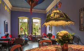
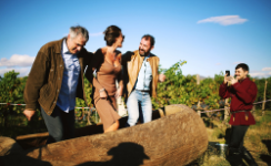
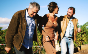
We don’t just plan tours, we compose them with a colourful pallet of unique experiences. Be warmed by heartwarming hospitality. Drink unique wines and spirits. Taste the rich flavors of the local cuisines. Feel the soft breeze of the Black Sea shore. Become enchanted with the snowy slopes of the Caucasus mountains and the rising sun’s purple haze across the tranquil Alazani Valley. Come to life with the sacred beats, rhythmic strums, and alluring reeds of the traditional music and dance. Experience a land set apart from time, filled with cultural treasures and unforgettable memories. With us, your journey turns into something truly remarkable and unforgettable: not just a souvenir trinket bought at a local market, but a memory that stays imprinted on your heart forever.
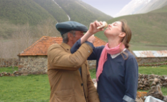
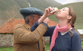
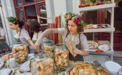
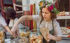
Explore the rich flavors of traditional Caucasian dishes. Indulge your taste buds with regional specialties prepared with care by renowned chefs or kitchen household wonders.
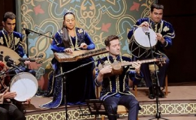
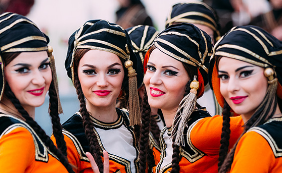
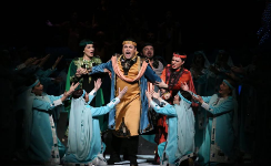
Don’t miss the region’s breathtaking dance performances and folk shows, which portray the art, culture, and customs of the many nations of the Caucasus.
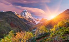

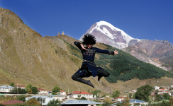
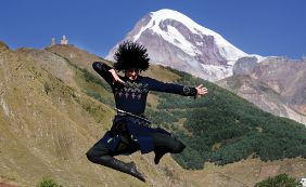
Begin your day with a breathtaking sunrise in the stunning Caucasus Mountains. Unwind and soak up the positive energy before a day full of exciting adventures capturing the unforgettable scenery.


Gain exclusive access to the studios of renowned actors, painters, sculptors, dancers, artists, and photographers. Explore the creative behind-the-scenes world and take part in the cultural conversation.
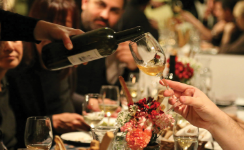

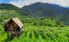
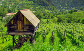
Georgia, with its rich 8000-year history of wine production, is an excellent destination for wine enthusiasts, where there is nearly 500 distinct grape varieties still cultivated today. Explore and indulge all you can.


Ararat Valley grape varieties, spring water, and time-honored distilling techniques combine to give Armenian brandy its distinctive flavor and golden hue. Join in on a brandy tasting at one of the most famous factories in Armenia.
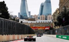

During the exciting days of the Formula 1 Azerbaijan Grand Prix Race, the streets of Baku are overflowing with celebrating spectators. The rush of excitement will be certain to leave a lasting impression on your memory forever.


Engage with influential people from the worlds of art, science, technology, sports, and politics at lectures and other events specially organized for you.
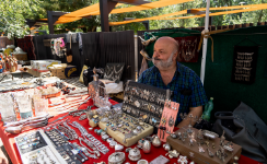
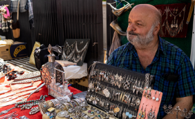
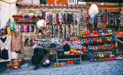
At the local flea market known as Dry Bridge, there gathers hundreds of sellers of trinkets, used treasures, and kitschy souvenirs. Find some real gems here haggling with the sellers for the goods spread on their blankets.
Delve into the rich history of Georgian winemaking by tasting the flavors of wines that have been perfected over 8000 years. Discover the unique qvevri wine of Georgia, listed as an Intangible Cultural Heritage by UNESCO.

Embark on an unforgettable and unique adventure in the amazing Caucasus Mountains, where our team of internationally certified mountain guides await to take you safely through the perfect snow of off-piste skiing.
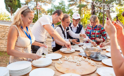
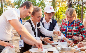
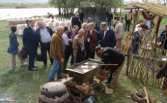
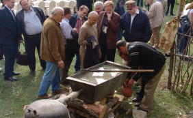
Our traditional food masterclasses are the pinnacle of culinary education and are sure to satisfy any foodie's cravings. The holy traditions of Georgian food and hospitality are revealed via this immersive cultural experience
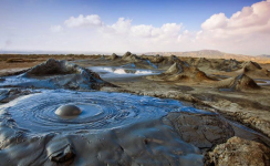
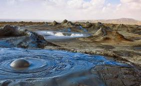
A flat of mud volcanoes stretches across the horizon like an alien world. Messy, bubbling and explosive, these small volcanoes cones are impressive and beautiful. Azerbaijan is a home to nearly a third of the world’s mud volcanoes.
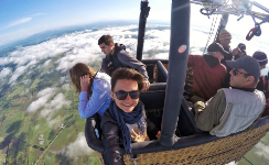
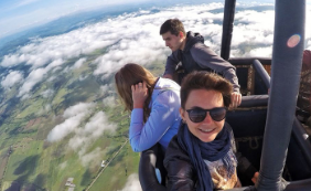
Take to the skies in a hot air balloon and discover breathtaking aerial views of the valley below, adorned by the snow-capped peaks of the majestic Caucasus Mountains


Enjoy the fresh Caspian Sturgeon Black Caviar and Sparkling Wine while lounging on the deck of a private yacht and taking in the lovely views of Baku Bay.
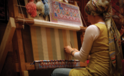
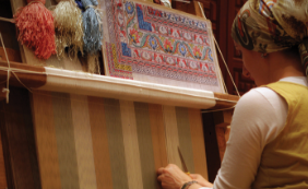
She is not making a flying carpet, but rather a beautiful icon of Azerbaijan, a country steeped in history and culture where carpet weaving has been practiced for centuries.
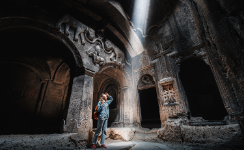
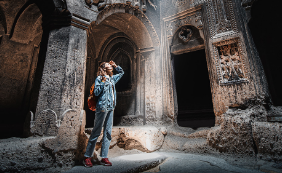
Monasteries carved into the depths of caves, ancient temples hanging on cliffsides… the Caucasus overflows with spiritual gems from ages past, that sweep the senses in detail both visual and beyond.
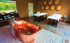
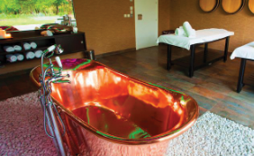
Take pleasure in a wine spa, experience peace and pleasure, and heal your body and mind with luxurious rituals, massages, and cosmetic services.
Experience exceptional events and luxurious amenities in the most unexpected of places: off-the-beaten-path locations dotted with historical ruins, ancient cave towns, majestic mountains, arid deserts and more.
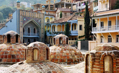
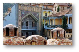
Honored visitors to the capital city have long been invited to the old dome-topped sulfur bathhouses. Soak for an evening in a beautifully tiled haven and enjoy a qisa, or exfoliation scrub, and a massage.
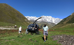
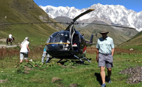
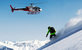
Careen across mountain slopes with expert pilots and guides and discover the mountains from the perspective of the birds. Land in untouched and lost worlds of beautiful hidden valleys inaccessible by car or foot within your timeframe.
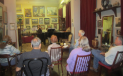
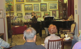
Participate in cultural events held in historical buildings, house museums, artist studios, galleries, and other noteworthy locations. Classical music, polyphonic singing, and more are often featured at these exclusive meetings.
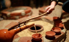
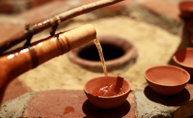
Participate in distilling chacha, a grape brandy with genuine Georgian roots. It’s made from grape pomace and often used as a “medicine”. Take care not to have too much, you might not remember how much fun you had!

Learn about the history of the Georgian Cloisonné technique of enameling. Using this age-old method, you can design and create your own original work of art - undoubtedly the ideal memento to bring back from a trip.
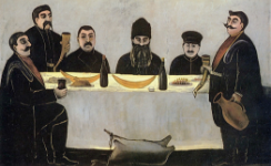
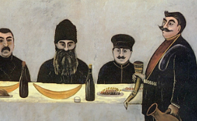
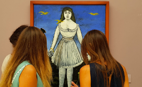
Lead the Georgian feast as a Tamada, the toastmaster (as on picture of famous Pirosmani). Learn the ancient toasting rituals, poetry, and conduct of a proper supra, or feast. For the most special toasts, drink wine from a sheep’s horn!
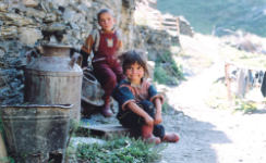
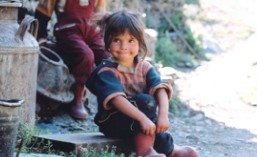
Visit remote mountain villages where you can feel the time stand still and be one with the simplicity of older times. The people are still genuine and true, and meet you with an honest hospitality and friendliness.


The Caucasus Mountains are some of the most scenic and breathtaking in the world. Expert guides will take you down some of the best off-piste runs to give you a truly unforgettable mountain adventure experience.

Get warmed up by the authentic hospitality of the locals wherever you go and enjoy the different cultural aspects that vary from region to region. Take part in surprisingly stimulating conversation on a wide range of topics.


A fun and engaging activity for those who appreciate wine and enjoy challenging their intellect. Discover the rich tradition of Georgian winemaking and put your knowledge to the test in the field of wine. There are no losers here!

Be immersed in the enchanting world of the East during your visit to Azerbaijan. Savor authentic local cuisine while losing yourself in the soulful melodies of mugham music: You’ll feel like you’ve stepped into a page from a fairy tale.
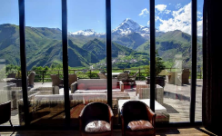
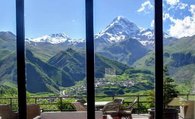
Take in the views at the lobby of the luxurious Rooms Hotel situated at the foot of Mt. Kazbegi, where you can sip on fine wine and dine on elegant Georgian cuisine, then pamper yourself in the spa after your hiking expedition.
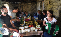

Enjoy genuine local hospitality, where a supra with a local family may unintentionally morph into a polyphonic performance led by the tamada, or toastmaster, and featuring your host and all the other guests.
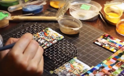
Azerbaijan is famous for its special carpet weaves. Learn about the patterns and methods of these beautiful masterpiece productions and order your own to ship back home.
Go on exciting journey from a charming farm to a picturesque fruit garden, lush vineyard, fragrant citrus orchard, verdant tea plantation, and rustic tobacco fields. Immerse yourself in the local culture by meeting the friendly locals.
Sit down for a sip of chacha with a shepherd in remote community high in the Caucasus Mountains, where it’s inaccessible for almost half a year. Participate in the indigenous life and customs.
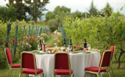
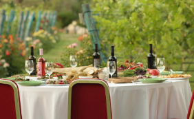
Experience the Georgian feast in its natural setting: the vineyard. With mountain peaks inspiring the poetry of the moment, feel the true heartbeat of the country as you imbibe on household wine and eat the freshest of meals
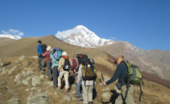
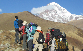
After exploring the stunning 14th-century Sameba Church, continue your adventure with a hike along the slopes of the magnificent 5054-meter-high mountain. Remember to pack your hiking shoes for your upcoming trip!
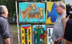
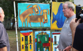
Beautiful artworks line the footpaths of the Dry Bridge market, often sold by the master painters themselves. Engage in conversation about the pieces and choose your favorites to ship back home and adorn your walls.
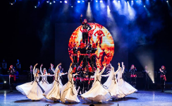
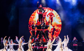
Renown for its rich and long tradition Georgian dance groups of Sikhishvili is not to be missed. Exciting, passionate, frenetic, theatrical, and graceful, their folk dancing performance perfectly captures the spirit of the Georgian people.
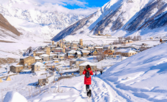
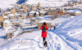
The beautiful towers of Ushguli await to keep you warm through the snow-covered months of winter. Stay in the highest continuously occupied settlement of Europe and experience winter treks through high powder.
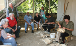
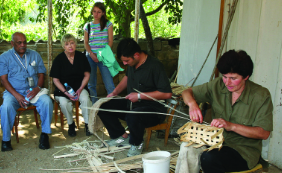
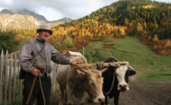
Skill tradespeople live throughout the Caucasus, whether at the tasks of basketweaving, pottery, winemaking, or more, these are hardworking people who are happy to spend a few moments and share some quality life-hacks.

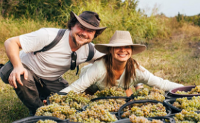
Help gather grapes during rtveli, the harvest season in Georgia. The vineyards and wineries come to life for the new harvest and are capped with a delightful Georgian supra, or feast, often held amidst picturesque vineyards.
Georgian cities has always been known for its artsy cafes full of hip youths and literary minds. Drink from cafes that feel like old-style living rooms, with revived antique furniture and inspiring décor.
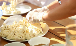
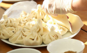
Traditional food of people from the mountainous regions of Georgia. Perfect khinkali, boiled dumpling filled with ground meat in dough, should have at least eighteen wrinkles and must be eaten by hand. Don’t spill the juices!
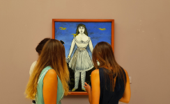
Gaze upon works by seminal Georgian avantgarde artists that rocked the Soviet Union, discover the Georgian naïve painter Pirosmani, learn about the history of Georgia and see Gold of Colchis and other ancient civilisation artefacts.
Participate in the real Georgian reality of winemaking. Help gather the grapes for the harvest and begin the process of making Georgian wine yourself. Learn about the local methods and even manufacture your own bottle of vino.
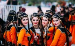
Experience national holidays and festivals when the streets overflow with celebrants. Georgians can never contain themselves when celebrating and often break out in impromptu song and dance.
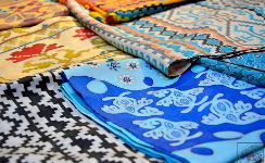
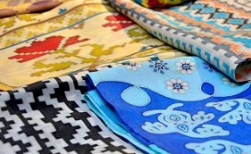
Visit craft studios and become immersed in a fantastic world of local textiles. See how ancient technics and ornamentation are transformed into something incredibly fresh and contemporary.


The Caucasus is a well of jazz music and improvisation, creating whole new spins on the genre. The jazz clubs of Baku and Tbilisi take on these stylings with amazingly talented musicians – real diamonds in the rough!
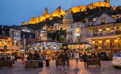
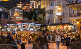
The main artery of Tbilisi’s old town, Chardeni, is named after a medieval French explorer. Follow his footsteps along a street of bars and clubs that spill out onto the narrow alleyways of the district.
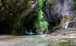
A ride on the pristine clear waters of the lush Martvili canyon is a breathtaking experience that must be had at least once in life. The raft is guided by a local, taking you slowly and safely on this relaxing and heavenly float.

Spinning yarn and weaving socks is a renown art in Georgia. Regularly done by passionate grandmothers for their babes, they’re also widely available in the souvenir markets to keep your toes warm on winter nights.


Everywhere in the Caucasus is a beautiful sight and a thrilling experience. It’s a photographer’s dreamland. Pack your best camera, extra SD cards, and film and prepare for a time when you can never put them down.
Festival times bring merry times throughout Georgia, from Spring wine festivals to town and village festivities jumping from one location through the next. Have fine cookies or some mtsvadi BBQ, drink some wine, and make merry!

Many Georgian names can be found among famous performers of European and World Opera, Ballet, Classical Music. (Balanchini, Ananiashvili, Burchuladze, etc.) Watch from where they began and discover the next big star!

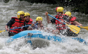
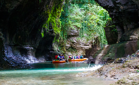
Pristine white-water rapids carve through the myriad of scenic mountain canyons of the Caucasus. Indulge in a relaxing evening of wine and barbeque on the picturesque banks of a lively river after a thrilling day of aquatic adventure.
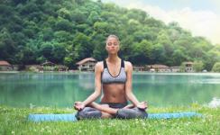
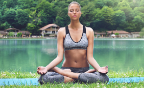
Revive yourself in the beauty of the Caucasus. Soak in the sun, breathe the fresh air, and completely reinvigorate your sense of being in this perfect destination of rediscovery.
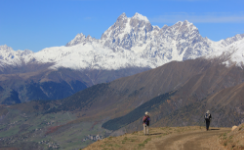
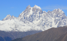
Take a deep breath when observing the views of the Caucasus Mountains, the home of the titans of old. Discover these fierce peaks, take in the majestic views, and treasure forever your lifelong impressions and unique experiences.
and more,
more...
OR
GO HOME PAGE